By Chris Thomas
Drones are aircraft either controlled by pilots from the ground or independently following a pre-programmed mission.
Local governments are expanding their use of domestic drones for routine aerial surveillance for golf course management, search and rescue, firefighting, and more.
Law enforcement. Firefighting. Riot suppression. Search and rescue. Disaster control. Planning and zoning. Environmental mapping.
These are just a few of the possible ways that unmanned aerial vehicles (UAVS), also known as drones, can be used in local communities. In Mesa County, Colorado, for example, the sheriff’s department uses a drone to take high resolution images of a crime or accident scene.
The drone takes images that overlap each other. By using special software, these images can be recalibrated to the ground where distances and areas can be measured accurately and at an extremely high resolution. These same images then can be processed into 3D orthomosaic photos—a group of images stitched together to create a panorama of the ground—saving the scenes forever.
When images of the scene are loaded into the software and an orthomosaic produced, then references to exact ground markers are entered, either as landmark points or GPS referenced points. With these markers, the software recreates an exact replica of the scene in the exact scale of the scene. The scene can be loaded by KML or KMZ files into Google Earth or a GIS system and reproduced any time in the future.
Another useful application is first-person video (FPV), where the pilot and a group of people can watch video from a drone camera in real time but keep a safe distance away. Disasters, police standoffs, fires, or hazardous waste spills can be watched or examined without putting additional personnel in close proximity of danger.
How Drones Work
Named after a working male honey bee, a drone is a device that uses a group of sensors to measure velocity, orientation, gravitation, wind speed, and more and send data to a controller (a small computer) that mathmatically processes that incoming data. Signals are then sent to control surfaces that manage the pitch, roll, and yaw of the flying device.
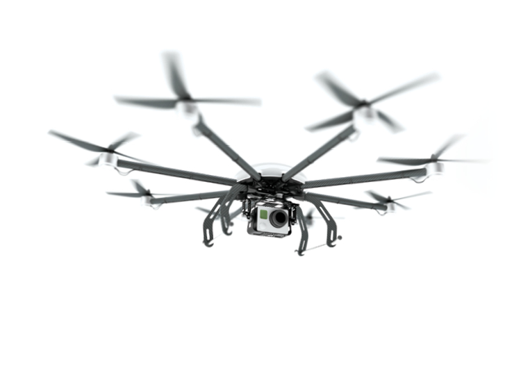
Fixed-wing drones (plane platforms) are controlled by an elevator, rudder, and aeileron. Rotary drones (four, six, or eight separate engines and propellers) rely on the speed of each blade for control.
The controller is always sending signals to those control surfaces and receiving feedback from the sensors and forcing the drone to fly to a specific spot and on a specific flight line. Typically, it sends and receives data and makes changes to controls about 50 times per second.
Both types of drones can be used to monitor and map areas. Fixed wing drones that fly a preloaded mission flight plan via their autopilot can be easily made to cover specific areas with images and with other sensors.
Fixed-wing drones provide a stable platform and cover a lot of area. They do require some altititude to fly safely, so the resolution of the images are slightly less (two to three centimeters per pixel) than that of a rotor drone that achieves better resolution since it can fly at a lower altitiude (less than a two-centimeter resolution per pixel).
Pilot Experience Is Key
With all the positive ways that drones can be used, they have downsides as well. The first and most important thing about all drones is this: Each flies in the air, either with wings or rotors—so a qualified person is needed to control the flying and do so safely.
From my experience, rotary drones are easy to fly. Anyone can pull a rotary drone out of a box and generally be flying it in a few minutes; however, to be competent with certain applications, it takes considerable practice. Many a story has been told of a person getting a new rotary drone, attaching a “gopro” or video camera and flying it straight up in the air several thousand feet.
As unsafe as that is, it does happen quite often. The person who flew his phantom multirotor system onto the White House grounds this past January at 3 a.m. did that, but he claimed he had a “flyaway,” which is when a drone is incorrectly calibrated or feedback through the system tells the drone to go to another location.
It’s interesting that the maker of that drone stated the next day that the company could limit areas where these drones could and couldn’t fly, and the area around the White House is now off limits. If the manufacturer knew it could erect a no-fly zone in the devices’ software, perhaps it should have updated the software earlier.
Fixed wings are much harder to handle. It takes talent and experience to fly these. Generally, it takes practice time to be adept at handling them because they need to take off and land, and that takes knowledge.
Crashes can be costly when it comes to drones. With platforms costing anywhere from $3,000 to $50,000 depending on the system and attached cameras or sensors, and when the potential liability of people and things they could crash into are added to the cost, the liability can grow exponentially.
Types of Applications
A local government that owns a drone can use it when and how it wants to within legal and FAA requirements, which includes not flying the drone more than 400 feet high, no closer than five miles from an airport, and within the line of sight to the drone. This means during a disaster or emergency, a law enforcement agency can use one quickly if it has the know-how and a capable pilot.
Departments can map or video areas as often as needed to document or show changes. Near infrared radiation (NIR) and multispectral imagery can be incorporated that shows plant stress and areas on golf courses that need more or less water, which can greatly reduce fertilizer and water costs.
Some systems have the ability to carry light detection and ranging (LIDAR), which is a remote-sensing technology that measures distance by illuminating a target with a laser and analyzing the reflected light. It produces accurate 3D models, and infrared sensors detect any changes in terrain, development, watershed, river, and stream runoff.
The pilots flying any of these platforms have to practice until it is such a routine that it is semi-boring. Interesting enough though, I have been piloting drones professionally for six years and there are places that drones can go that still make me slightly nervous, like landing one on a short road with 200-foot pine trees surrounding the area. Unexpected changes in wind direction and wind speed, engine failure, and structural failures also can happen.
I tell potential pilots to do everything they can to plan ahead because you don’t want to be the person in the news for doing something less than responsible with a drone. You will be the test case, and that is not where you want to be—similar to the man involved in the White House drone situation, who was a geospatial expert but perhaps had been drinking.
When it comes to drone pilots, I want to repeat this again: Never put someone in charge of the drone fleet that doesn’t know how to manage and fly the drones. This experience should not just be on a simulator, but someone who knows the real world outcomes and variables.
Drones have certain tendencies, and these must be included in mission decisions, including takeoff location areas, terrain features in the flight area that can create obstacles, and wind patterns at certain times of the day. Drones also don’t fly well during hot, dry days.
The bottom line is: No one should be able to tell the pilot in charge to fly a drone when he or she thinks it will not get imagery safely and will perhaps be destructive to the drone.
New System Developments
Drone developers are trying to take the qualified pilot out of the circle by calling their platforms autonomous, including takeoffs and landings where everything is controlled by the pilot or controller, even the pre-programmed flight plan. These systems are generally the ones the FAA should worry about causing damage and in my opinion, should highly regulate.
Some systems are reliable and some are not. I have seen autonomous fixed-wing drones—those that function and operate independently—take off and then go in a different direction and at a much higher speed than the person who submitted the mission’s flight plan for the drone thought they would.
I was once involved in such a flight when, after takeoff, the drone turned 90 degrees and flew away. We found the wings floating in a river some three miles away. We didn’t find the remaining parts; it’s a good thing we were testing in a remote area.
I’ve also seen the autonomous landings of fixed-wing mapping drones and watched them hit the ground and break in half. If a local government just paid $50,000 and found that had happened, it would not be a good situation.
To label a drone autonomous is somewhat irresponsible in itself. Next time you’re in line at the grocery store, consider if each shopper bought an autonomous drone and could fly it around your neighborhood. Would you be concerned about it? I would.
People that do this need to know something about the physics of drones and how they work because having a working drone in a local government department would require someone to be on top of it every day. For such a program to be successful, I can’t stress this enough.
Law enforcement and fire departments need to know this equipment would need to be available at any moment, and this takes a lot of money and effort. Generally, a backup drone and backup to the backup are needed.
Batteries must be kept completely charged, and the flying platform has to be kept in good shape, at all times. It will probably require two or three qualified pilots and maybe several ground-control people watching the flight, too. It also takes someone to process the images or video once they are completed, and that’s just the basic setup. A person who programs controllers, rebuilds crashed drones, or builds payloads might also be needed and exponentially increase the cost of a drone program.
In general, my experience as a professional pilot has shown me that a local government’s drone fleet will be cheaper in the long term if contracted with a specific drone company. It will have the expertise and will know the challenges and probably have already worked through much of the learning curve that might take a local government time and money to do, plus the liability will be a fraction of what it could be. All of which underscores the point that there is a lot for local governments to consider before they send in the drones.
What’s Up Out There?
If drones are being used by local governments, managers are invited to share how they are used and any details and experiences they have learned to help others who are considering such an investment. The information will be published in an upcoming issue. Send the information to bpayne@icma.org by April 30, 2015.
Resources
Federal Aviation Administration website, Civil Operations: https://www.faa.gov/uas/.
CNN, February 15, 2015, “FAA to Announce New Rules for Flying Drones”: http://www.cnn.com/2015/02/15/politics/drones-new-rules/index.html.
USA Today, February 16, 2015, “FAA Unveils Drone Rules; Obama Orders Policy for Agencies”: http://www.cnn.com/2015/02/15/politics/drones-new-rules/index.html.
New, Reduced Membership Dues
A new, reduced dues rate is available for CAOs/ACAOs, along with additional discounts for those in smaller communities, has been implemented. Learn more and be sure to join or renew today!