By Terri Jones
Discussions about drone technology have been all the buzz for local government over the past few years. With that buzz came grandiose ideas and brainstorming sessions of how to use drones to better serve constituents—some of which are just now coming to fruition. Many show the immense benefits government can obtain for disaster recovery, resiliency, and resource planning.
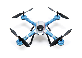
Drone technology, equipped with high-resolution video and photography capabilities, provides a brand-new opportunity for many government agencies. Images alone, however, can only accomplish so much.
Although the video and photo resolution far surpasses what has been available in the past, those videos and photos are only as good as the data behind them.
Today, government agencies are finding new and innovative ways to harness that data, connecting photos and videos to GIS and information management technology. This connected data empowers more informed decisions.
A Special Perspective
Drones provide perspectives that government agencies didn't have before. Compared to the former plane fly-over processes, drones cost less and take better-quality images for monitoring project progress or the scale of a climatic event. The implications for using drone technology are numerous and continue to expand by the day.
We've seen some great examples recently within resource planning, disaster recovery, and resiliency, because it helps those departments gain an improved perspective they didn't have before.
Drones in practice today, for example, can take imagery to help estimate volume. This is something that comes in handy within resource planning to estimate tree cover, beach erosion, or receding water levels.
The images gathered by drones, paired with mathematics, GIS mapping functionality, and information management, turn into insights. This assists governing bodies by providing a convenient and inexpensive way to connect information and make more informed decisions.
This includes whether water-saving techniques need to be implemented, when to begin construction on a new road to break up high-traffic roadways, and whether those roads would be affected if there was a flood.
Key Role in Disaster Recovery
Another area where drones are becoming extremely prevalent is disaster recovery. Prior to drone technology, many government entities felt they were at the mercy of disastrous events.
Today, those governments feel empowered by their disaster recovery and resiliency planning. By incorporating the right technology solutions, they are better able to see damage caused by catastrophic events, automate response processes, and outfit fieldwork as soon as possible to better serve constituents and gain emergency funding assistance.
After a flood, government employees can send out drones to view images and video and assess the damage, which has been done in the case of hurricane damage during 2017. They can then input that data into GIS mapping technology to mark affected areas, noting where damage is most prevalent and where only minor damage occurred.
By connecting those maps with drone images—and any other relevant documentation with an enterprise information platform—government employees have one-click access to all information related to the flood. The information management system can then kick-start the process for federal emergency funding to receive assistance as soon as possible.
Horry County, South Carolina, the governing body of Myrtle Beach, recently put its drone, GIS, and information management technologies to the test. A year prior to Hurricane Matthew, the county was using its new drone technology to map beachfront and monitor for erosion.
When Hurricane Matthew struck in October 2016, the county suffered immense damages, including inland flooding and severe beach erosion. Because the government invested in drone technology a year prior and routinely flew its drones to gather images of its beaches to proactively monitor for erosion, it had images from before and after the storm to showcase the detrimental impact.
Horry County quantified the impact Hurricane Matthew had on beach erosion within days, showing that six to eight feet of beach was lost, data that previously took weeks to assess and achieve.
Forward-Thinking Approaches
Additional functionality within an enterprise information platform can be leveraged to collect important data in an efficient and cost effective way to further bolster the capabilities of a GIS solution.
Such functionality as geocoding information to mark a dot on a map and pull up documents like permitting documentation, tax bills, and building plans gives government immediate access to necessary information. This can empower more informed decisions.
Government faces the same challenges as any organization in today's tech-savvy world: How to evolve in the digital age and use the right technology to benefit its constituents. Fortunately, many technology vendors work directly with local, state, and federal government agencies to build solutions that solve everyday problems.
More governing bodies are taking a forward-thinking approach and implementing innovative technology like drones, GIS, and information management to take the important data they collect every day and provide actionable intelligence to the forefront, thus using drones to drive more informed decisions.
They then have the ability to not only make better decisions based on images and video gathered from drones, but also proactively plan and enact disaster recovery initiatives. By the time this article is published, I suspect that much will have been done with drones to assess the damages caused by hurricanes Harvey and Irma.
Terri Jones is marketing manager, government solutions, Hyland, Charlotte, North Carolina (Terri.jones@hyland.com).
New, Reduced Membership Dues
A new, reduced dues rate is available for CAOs/ACAOs, along with additional discounts for those in smaller communities, has been implemented. Learn more and be sure to join or renew today!
