In December, Greg Davidson from the CityLinks team and Hamid Mirfenderesk, a municipal coordinator for natural hazard management within Gold Coast, Australia arrived in Semarang, Indonesia to gain an understanding of the challenges the city is facing as it adjusts to the impacts of climate change. The two were joined by Professor Aris Marfai (UCCRN) who provided a scientific and academic perspective to the partnership. This was the first exchange under the Semarang - Gold Coast Climate Change Partnership.
During the weeklong exchange, the Semarang municipality hosted a number of meetings and activities which helped the program prioritize the focus of the partnership. The team met with the Bureau for Planning and Development, Infrastructure and Planning Division, Department of Fisheries, members of Mercy Corps who were implementing a mangrove rehabilitation project, and various members of the community. In addition to meetings, which focused on the challenges Semarang was facing and all of the approaches that have been utilized, the team traveled to multiple parts of the city to see the work and challenges firsthand.
There is a one meter tidal variation in the region which causes flooding within the city on a daily basis in addition to the flooding caused by rainfall. There is a short distance between the mountain range and the city, which means there is little time for the rain to be absorbed into the ground. Because of this, the land is not able to handle the increased incidences of rainfall due to climate change.
Two areas are experiencing intense flooding more notably than anywhere else. The first area in the eastern half of the city is a slum area owned by the port authority and various industries called Tambak Lorok. It is mostly filled with low income housing, docks, and warehouses. The main livelihood in the area is fishing, but due to flooding and pollution, the fishponds are all but lost. Some individuals are shifting from fishing, to growing and selling mangrove trees from seed. All disposable income in this area is used to protect homes from flooding.
Tambak Lorok is also in close proximity to industrial areas – all of the industrial activity is zoned to take place in the coastal area. One kilometer of the coastline in this area has been lost in the last 20 years. Residents still own rights to land which is now one km out into the sea.
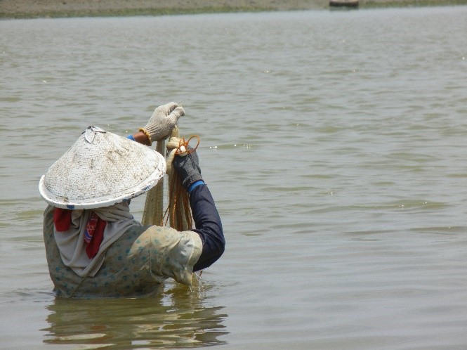
The second region experiencing more notable flooding in the western half of the city is more rural and consists primarily of mangrove forests and commercial fishing ponds zoned as a conservation area. It is owned by a private development firm and is currently being managed by fisheries.
There are several activities being implemented to deal with flooding and coastal erosion. In the western section of the city, where the fish ponds are located, the primary defense is through planting of mangroves and impermanent and impermeable sea walls made of sticks. The purpose of these walls is to act similar to mangroves - allowing sediment to flow through it and then settle and accumulate behind it. It is being implemented with fishermen and community members.
In addition to the trees and permeable walls, there are seawalls made from used tires and filled with mud.

A young boy helping his father raise the ground floor of their home so it will be higher than the flood level.
These are used as barriers to protect the new mangroves from being washed away. These mangroves need about 7 years of growth before they no longer need wall protection.
However, internal flooding due to rainfall has overworked the sewage system, and the water flowing into the mangrove area is polluted, which has slowed the maturing process of the trees. The large tidal variation also washes out trees before they have a chance to mature. Because of this, there has been limited success.
To deal with rising waters in the area, the municipality is forced to raise the level of the concrete roads on a yearly basis to keep them from being flooded. As a result, homeowners are raising the level of their first floors to match or be above the level of the road. The result is houses with first floors nearing the ceilings as people continuously pour either concrete or soil to raise their floors above flood level.
As a result of the meetings and field visits during the exchange, the team identified a critical gap in the city’s understanding of its coastal erosion processes, particularly around longshore sediment transport. The City of Gold Coast will develop a hydrological model to help Semarang better understand the erosion processes so that the municipality’s policies can be better informed.
The next exchange of this partnership will occur in early 2016.
New, Reduced Membership Dues
A new, reduced dues rate is available for CAOs/ACAOs, along with additional discounts for those in smaller communities, has been implemented. Learn more and be sure to join or renew today!